
Tarradale Through Time Project Areas

We have constructed six archaeological sub-projects for investigation as we consider these to be the most relevant for providing data for analysis of the project as a whole as well as illustrating the diversity of the heritage and providing a wide range of experience for the volunteers and trainees.
Shell midden investigations. Plough damage on a shell midden site in 2010 led to small-scale test pitting with retrieval of organic remains radiocarbon dated to 6500 and 6200 cal BCE. There are several other shell middens identified from field walking that we propose investigating as they are at different heights above sea level and could be any age between 8000 BCE and 4000 BCE and may provide evidence of temporal changes in material culture and subsistence as well as evidence of the impact of the Storegga tsunami in the inner Beauly Firth. Excavation in 2017 by Tarradale Through Time uncovered a fine assemblage of antler tools at one midden site dating to c. 4000 BC.
2017 Data Structure Report.

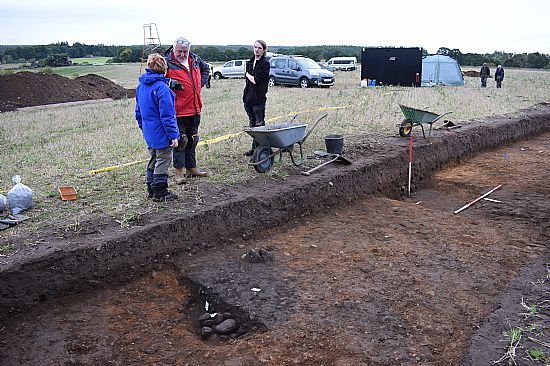
Tarradale castle ditches exploratory excavations. Geophysical survey by the University of Aberdeen (on behalf of NOSAS) perhaps suggested the survival below the current plough surface of buried ditches and other structures of a motte and bailey castle. Tarradale was an important stronghold in the 13th and early 14th centuries until captured and destroyed by Robert Bruce in 1308. Nothing survives above ground. The castle was not located during excavations in Autumn 2017.
2017 Data Structure Report.

Tarradale abandoned postmedieval settlement. Several houses of poor tenants (mailers) are shown on the 1788 estate map but all had disappeared by the time of the first edition of the Ordnance Survey. Scrub vegetation has been cleared from the site revealing the footings of five or six buildings. Survey and exploratory excavation was carried out at the site in Spring 2018.

Balvattie settlement exploratory excavations. Aerial photography shows crop marks indicating the existence of a former enclosed and possibly defended settlement with several ditches and pits; field walking has found considerable amounts of medieval pottery and slag in the area. The site was excavated in Autumn 2018.
2018 Data Structure Report.
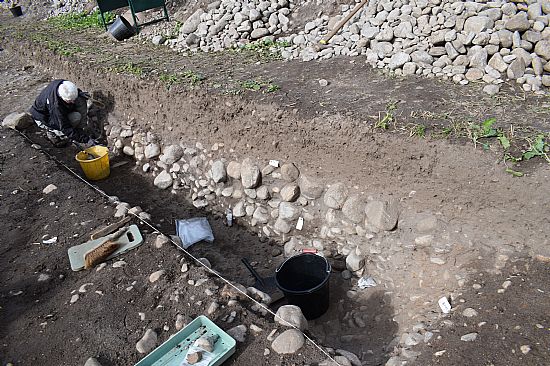
Gilchrist promontory fort exploratory excavations. Aerial photography shows crop marks for a series of banks and ditches that cut off a small promontory that once projected into a kettle hole (now drained). Excavation is required to ascertain whether the banks and ditches represent the landward defences of a promontory fort and when they were constructed. The site was excavated in Autumn 2018.
2018 Data Structure Report.
Tarradale barrow cemetery and settlement site exploratory excavations. The University of Aberdeen (on behalf of NOSAS) undertook geophysical survey of the ploughed out area of Tarradale barrow cemetery, one of the largest barrow cemeteries in the North of Scotland with the result suggesting a range of surviving features below the plough soil. The site was excavated in 2019. A summary of the results can be see here.
2019 Data Structure Report.

